Drawn From Memory: The Neighbors Sketching Maps That GPS Will Never Know
There's a map tacked to the wall inside a community center in Albuquerque, New Mexico that won't help you find a gas station. It won't reroute you around traffic or tell you the nearest coffee shop's hours. What it will do is show you exactly where Mrs. Delgado used to sell tamales from her front window every Saturday, where the neighborhood kids built a legendary ramp in 1987, and which corner still smells like fresh tortillas if you walk by before 8 a.m.
That map was drawn by hand, by a group of about a dozen neighbors over the course of three Sunday afternoons. And it's one of thousands quietly appearing in community centers, library bulletin boards, and living room walls all across the United States.
When the Algorithm Doesn't Know Your Block
Here's the thing about digital maps: they're remarkably good at getting you somewhere and remarkably bad at telling you anything worth knowing once you arrive. They'll show you the address of a barbershop but not that the owner, Mr. Curtis, has been cutting hair in that same chair since 1974 and keeps a jar of peppermint candies on the counter. They'll mark a park but not mention that locals call it "the Meadow" and have for three generations.
That gap — between location data and lived experience — is exactly what the hand-drawn map movement is filling in.
Community cartographers, as some have started calling themselves, aren't trained geographers or urban planners. They're retired teachers, high school students, longtime renters, and recent transplants who share one thing in common: they actually know their neighborhood. And they want to show it.
What Goes on a Map That Matters
Ask anyone who's participated in a community mapping project and you'll get a different answer about what belongs on the map. That's kind of the whole point.
In a small town in rural Georgia, a group of Black residents created a map documenting sites connected to their community's history — churches, family homesteads, burial grounds, and gathering spots that predate the town's official records. Some of those locations don't even have street addresses. But they exist in memory, and now they exist on paper.
In a neighborhood in Portland, Oregon, a collective of artists and longtime residents spent months sketching a large-format illustrated map that doubles as a mural. Businesses are represented not by logos but by tiny drawings of what makes each one distinct — the flower shop with the wind chimes, the bookstore with the cat who sleeps in the window. Visitors who pick up a printed copy often describe it as the most useful thing they've found for actually understanding the neighborhood.
In Chicago, a high school class produced a walking map of their South Side block that documented oral histories from residents who'd lived there for forty or more years. The map became part of a local history archive. A few copies ended up in the hands of families who had moved away decades ago and wept when they saw their old addresses rendered in careful ink.
The Tools Are Humble. The Results Aren't.
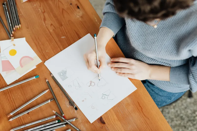
There's no special equipment required to join this movement. Most community mapmakers work with supplies you'd find at any craft store — watercolors, fine-tip pens, colored pencils, and a decent ruler for anyone who cares about straight lines (many don't). Some groups scan and print their maps for wider distribution. Others keep them entirely analog, hanging originals in public spaces where people can add notes, corrections, and contributions over time.
The living, evolving map is actually one of the more compelling formats. A wall-mounted version in a Brooklyn community garden has been growing for two years. Neighbors add stickers, handwritten notes, and tiny drawings as new things open, old things close, or memories surface. It's less a finished document and more an ongoing conversation about what this particular corner of the world means to the people who call it home.
Why Now?
It's worth asking why hand-drawn maps are having a moment in an era when you can get satellite imagery of your backyard with three taps on your phone. Part of the answer is probably a reaction to exactly that — a hunger for something that feels personal and rooted rather than universal and frictionless.
But there's something else going on too. In a lot of communities across the U.S., rapid development, displacement, and demographic change are reshaping neighborhoods faster than official records can track. Long-term residents watch familiar landmarks disappear and worry that the stories attached to those places will disappear with them. A hand-drawn map is one way to say: this existed, this mattered, and we're not going to let it vanish without a record.
For newer residents, participating in a community mapping project is often one of the fastest routes to actually understanding where they've landed. There's something about sitting around a table with people who've lived in a place for decades, listening to them argue about whether the old hardware store was on the left side of the street or the right, that no neighborhood Facebook group can replicate.
Maps as Heirlooms
What's striking about the community cartography movement is how seriously people take the finished products. These aren't throwaways. Families frame them. Organizations laminate and archive them. Some have been donated to local historical societies. A few have been reproduced as prints and sold at community fundraisers, with proceeds going back to neighborhood organizations.
In a lot of ways, a hand-drawn community map functions the way a family photo album used to — as a document of something real and irreplaceable, made more valuable by the fact that it couldn't have been produced by anyone else. The specific knowledge embedded in it, the inside jokes rendered in tiny illustrations, the buildings labeled with what everyone actually calls them rather than their official names — that's not data you can crowdsource from strangers.
That's community. And it turns out, when you give people a blank piece of paper and a reason to put what they know on it, they'll fill it in beautifully.
Start Your Own
If this sounds like something your neighborhood could use, the barrier to entry is genuinely low. Gather a few people who know your block. Bring paper, pens, and snacks. Ask everyone to name the five places that matter most to them within walking distance, and why. Start drawing.
You don't have to be an artist. You don't have to be accurate in the GPS sense. You just have to care about where you live — and be willing to put that care down on paper for whoever comes next.